New weather trouble? Tropical Storm Ernesto could form Monday
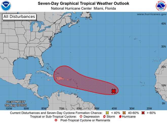
A tropical disturbance in the Atlantic Ocean could become Tropical Storm Ernesto on Monday night, and bring swells and a potentially increased risk of rip currents along Florida East Coast beaches later this week.
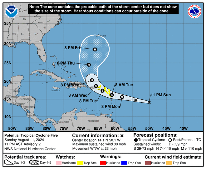
On Sunday, the National Hurricane Center began issuing advisories for the storm, calling it Potential Tropical Storm 5. Its track forecast calls for the system several hundred miles east-southeast of Antigua to become a tropical storm on Monday night and a hurricane by Wednesday evening.
The storm is forecast to move near or over Puerto Rico on Wednesday as it begins a northward turn into the Atlantic. But forecast tracks for potential tropical cyclones are much more uncertain than usual because of the greater uncertainty in the initial center position, the hurricane center warned.
Residents and visitors in Puerto Rico and the U.S. Virgin Islands are advised to monitor the storm over the next couple of days, warned the National Weather Service in Puerto Rico.
The forecast turn to the north meant residents along the Gulf of Mexico coast in Louisiana and Texas are not expected to experience any impacts from the storm, said the weather service office in Lake Charles, Louisiana. In Florida, increasing swells along the coast could increase the risk of dangerous rip currents later in the week.
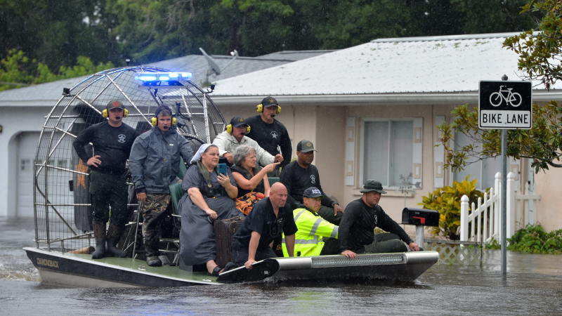
The storm comes just days after Debby inundated the Carolinas and much of the Mid-Atlantic and Northeast with flooding and strong winds. The tropical disturbance, or tropical wave, appeared Sunday morning to be getting more organized because of a lack of wind shear, or winds blowing in different directions, meteorologists said.

“That will allow for there to be additional, gradual formation," Zack Taylor, a meteorologist with the National Weather Service, told USA TODAY on Sunday.
If the system east of the Caribbean turns into a tropical depression, characterized by wind speeds up to 38 mph, it could next become a tropical storm, defined by wind speeds of 39 to 73 mph. After that, the storm, which would be named Ernesto, could be on track to strengthen into a hurricane.
Right now, other factors contributing to the storm's strengthening include less dry air, according to AccuWeather.

Tropical disturbance part of a likely above-average storm season
The high likelihood of tropical depression formation comes just days after scientists at the National Oceanic and Atmospheric Administration said the chance of an above-normal Atlantic hurricane season has increased to 90%.
The updated seasonal outlook from NOAA calls for 17 to 24 named storms to form, of which eight to 13 will spin up into hurricanes. (An average year sees 14 named storms, of which seven are hurricanes).
Those numbers include the four storms that have already formed this year, including deadly and devastating Hurricane Beryl and the current system menacing the East Coast, Tropical Storm Debby.
Federal forecasters said Beryl kicked off the hurricane season with an "early and violent start" when it became the earliest Category 5 Atlantic hurricane on record on July 1.
Storm trackers at Colorado State University also recently updated their hurricane season forecasts, predicting a total of 23 named storms. Of those, CSU scientists predict 12 hurricanes and six major hurricanes.

Where is the tropical disturbance headed?
As of Sunday, the tropical disturbance was moving westward toward the U.S. Virgin Islands and Puerto Rico, Taylor said. Residents of those islands should "continue to monitor" the rainstorm's whereabouts, he said.
Beyond the middle of this week, meteorologists can't predict the storm's exact track − such as whether it will head toward the southeastern U.S. or the northeast coast, Taylor said.
“A lot depends on exactly how the storm forms," Taylor said, adding there's also a chance the storm system could move away from the U.S.
Contributing: Doyle Rice, USA TODAY; Cheryl McCloud, USA TODAY Network − Florida
Disclaimer: The copyright of this article belongs to the original author. Reposting this article is solely for the purpose of information dissemination and does not constitute any investment advice. If there is any infringement, please contact us immediately. We will make corrections or deletions as necessary. Thank you.


