Hurricane Helene cranking up, racing toward Florida landfall today: Live updates
TALLAHASSEE, Fla. − Hurricane Helene strengthened to a Category 2 storm Thursday and grew even more powerful as it roared toward landfall and likely devastation along Florida's Gulf Coast.
A forecast from the National Hurricane Center shows the hurricane approaching landfall Thursday night as a Category 3 with winds near 115 mph. AccuWeather forecasters were predicting Helene would reach Category 4 strength − winds of 131 to 155 mph −in the Gulf and maintain that intensity into landfall.
Several Florida counties have ordered evacuations. Four of them − Franklin, Taylor, Liberty and Wakulla − with a total population of more than 70,000 people have ordered all residents to leave. Wakulla County Sheriff Jared Miller warned residents Thursday that Wakulla could face "catastrophic" storm surge.
"This will not be a survivable event for those in coastal or low lying areas," Miller said in a Facebook post. "There has not been a storm of this magnitude to hit Wakulla in recorded history."
On the forecast track, Helene will make landfall in the Florida Big Bend region Thursday night, the National Hurricane Center said. After landfall, Helene is expected to turn northwestward and slow down over the Tennessee Valley on Friday and Saturday. Florida will get hit first, but other states are bracing for a severe blow.
“Helene is a very dangerous hurricane and could become a ‘once-in-a-generation storm’ across western South Carolina and North Carolina, as well as northern and eastern Georgia,” AccuWeather senior director of dorecasting operations Dan DePodwin said.
Hurricane Helene tracker:See projected path of 'catastrophic' storm as Florida braces
Developments:
∎ The storm was centered about 255 southwest of Tampa on Thursday. Maximum sustained winds were 105 mph, and Helene was headed north-northeast at 14 mph.
∎ Florida State and Florida A&M Universities opened their doors to students and Tallahassee residents. The American Red Cross was using FAMU’s Al Lawson Center on campus as a shelter open to the general public; FSU was opening a refuge facility at the Donald L. Tucker Civic Center on Thursday to registered students who live off-campus.
Pastor offers church as shelter
Paul Nawlin, pastor of the First Baptist Church of Steinhatchee, rode his golf cart to Riverside Drive.Nawlin was checking on residents who live along the banks of the Steinhatchee River. Because some are staying through the storm, so will he. His church is fresh from a roof repair done Wednesday in preparation for Helene. Now, he says, it's ready to keep anyone dry who needs a place to stay as the hurricane bears down on their town.
"We're going to trust the Lord − no matter," Nawlin said. "He didn't ask us to understand everything. Just trust."
Power outages increase as Helene draws near
Thousands of residents in communities across the western coast of Florida had their power knocked out Thursday morning as massive Hurricane Helene closed in on the state’s panhandle and Big Bend region. Across the state, more than 30,000 utility customers were without power as of noon, according to a USA TODAY power outage tracker. There were over 8,000 outages reported in Collier County, over 6,000 in Broward County and over 8,000 in Lee County.
Outage totals are expected to grow as Helene moves closer to the state throughout the day and into Thursday night.
– Gabe Hauari and Anthony Robledo, USA TODAY
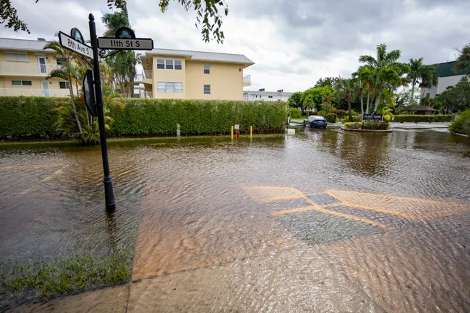
How much damage could Helene do in Florida?
Helene's true toll will depend on where it makes landfall, and how its other effects such as flooding, storm surge and tornadoes unfold. But its wind speed and category at landfall will especially affect power outages and structural damage. If it does hit at Cat 4 power, the storm by definition would be be expected to leave a trail of "catastrophic" damage. The National Hurricane Center says Category 4 storms threaten well-built framed homes with "severe" damage, potentially losing both roof and walls. Most trees are snapped or uprooted and power poles are downed.
"Power outages will last weeks to possibly months. Most of the area will be uninhabitable for weeks or months," the hurricane center says of Category 4 storms.
A Category 3 storm, while significantly weaker, is still a major hurricane. "Electricity and water will be unavailable for several days to weeks after the storm passes," the center says of Category 3 storms.
Learn more onthe Saffir-Simpson Hurricane Wind Scale and thedangers of storm surge.
− Doyle Rice
Riding it out on a fishing boat
In Saint Marks, 30 miles south of Tallahassee where two rivers meet before emptying into Apalachee Bay, a handful of residents and business owners watched the water rising by several inches every 30 minutes on Thursday. Stone crab fisherman Philip Tooke, 63, stood on the dock of his family owned Saint Mark’s Seafoods, watching the rain and for signs the wind direction was changing. He’s had head-height floodwaters beneath his building several times over the years, but he's worried what a 15-foot storm surge would mean. He and his brother planned to ride out the storm aboard their fishing boats.
“I feel sorry for them to the east, but if we don’t get that direct hit we’ll be ok,” Tooke said. “It ain’t got ‘bad bad’ yet. It will be by tonight. It’s not going to be pleasant down here.”
− Trevor Hughes
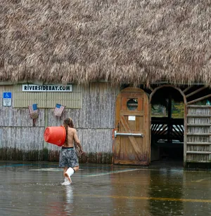
Parts of Carolinas, Tennessee face major flood threat
Flooding rain associated with Hurricane Helene will not be limited to Florida, eastern Alabama and southern Georgia. Overnight, as the massive storm moves inland, the southern Appalachians – from the northeast Atlanta area through the western Carolinas and eastern Tennessee – also face a threat of potentially “catastrophic” flooding, forecasters said.
In a Thursday morning update on Helene, Michael Brennan, the director of the National Hurricane Center, warned of widespread rainfall totals of 6 to 12 inches with isolated amounts as high as 18 inches. The torrential rain creates the potential for “life-threatening” flash and urban flooding, Brennan said, adding there’s potential for mudslides and landslides throughout the mountainous region.
The governors of Georgia and the Carolinas have declared states of emergencies as the fast-moving storm barrels toward the Florida coast.
"We will likely avoid the brunt of this storm, but it is still expected to bring flooding, high winds, and isolated tornadoes," South Carolina Gov. Henry McMaster said. "Take proper precautions and monitor local forecasts."
– Christopher Cann, USA TODAY
Flights canceled, airports closed
Over 1,000 U.S. flights were canceled by early Thursday because of Hurricane Helene, according to FlightAware. Tampa International Airport, St. Pete-Clearwater International Airport and Tallahassee International Airport in Florida all announced they will be closed for the day, but the storm's impacts extend beyond its projected path. Airlines began offering travel waivers earlier this week so customers could reschedule their plans around the storm.
Anyone whose flight was canceled is eligible for a refund under Department of Transportation rules. Federal laws do not require airlines to compensate travelers for delayed flights, but carriers have committed to various degrees of compensation for significant delays within their control. Read more here.
− Eve Chen
Did Helene delay or cancel your flight?What to expect from your airline.
Most Florida schools cancel classes
Most Florida schools were closed Thursday ahead of Hurricane Helene’s landfall, according to Florida Today, part of the USA TODAY Network. The Florida Department of Education issued a news release with a list of school closures, and the department said it’s working closely with districts to get them the resources they need to resume normal operations as soon as possible.
The University of Florida in Gainesville was closed Thursday, and Florida A&M University and the New College of Florida closed earlier this week, through Friday, according to the education department’s statement. At least 33 other colleges and universities are temporarily shutting down their campuses, according to the Florida Department of Education.
Dozens of school districts across the state are also closed, affecting K-12 students, as the entire state is blanketed in hurricane and tornado watches.
− Claire Thornton
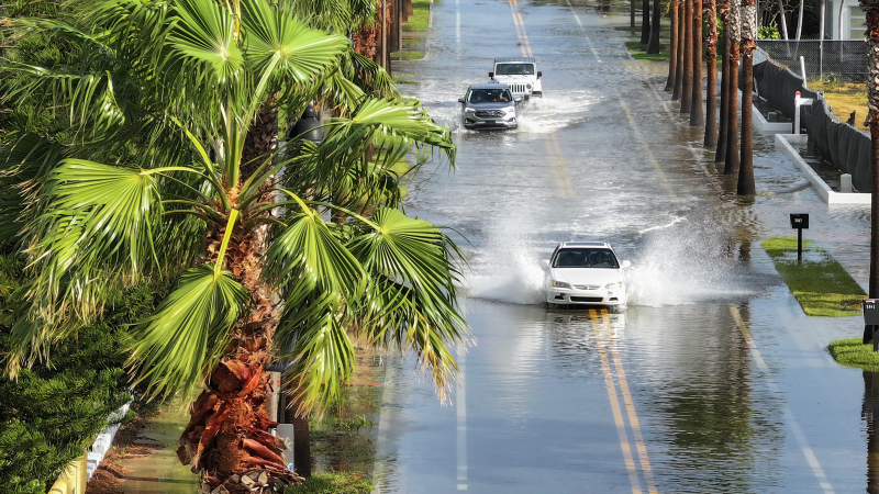
Flooding begins along southwest, central Florida coast
Floodwaters began to inundate roads along the central and southwest coast of Florida on Thursday morning. In communities including Fort Myers Beach, Sarasota, Venice, Bradenton and several in the Tampa Bay area, officials have announced road closures as heavy rain and storm surge lead to flooding along coastal and low-lying areas.
Sanibel city spokesman Eric Jackson, citing widespread flooding across the Lee County island, urged people not to drive on flooded streets. Molly McCollum, a meteorologist with the Weather Channel, captured video of fish swimming on a street in downtown Sarasota.
The National Hurricane Center expects a surge of water several feet high to come ashore along most of the western coast of Florida, with the highest level – 15 to 20 feet – projected to wallop the panhandle and Big Bend coast.
– Christopher Cann, USA TODAY; Dave Osborn, Naples Daily News; Sarasota Herald-Tribune
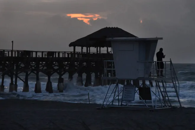
Couple in their 80s decide to hunker down
Taylor County Sheriff Sgt. Lee Harden's SUV pulled over Thursday at a home in the Steinhatchee coastal community, in the direct path of Hurricane Helene, after spotting a couple outside a home. Stan Ridgeway, 87, told the officer he's staying.
"I have to let you know ..." Harden began, reciting the details about the expected surge. Ridgeway said he knew.
Later, sitting in his living room, with his wife Jean, 81, Ridgeway said he bought his century-old house with its high elevation in mind. Floodwaters from Hurricane Idalia last year did not reach his home. Jean Ridgeway noted that this is the third hurricane since 2023.
"We didn't use to get hurricanes here," she said, then jokingly added: "I think they discovered this place and they liked it."
Lesson learned, residents evacuate Horseshoe Beach
Horseshoe Beach has become a ghost town ahead of Helene's anticipated landfall, the last few residents of the coastal community making final preparations before evacuating inland. The town was devastatedby Hurricane Idalia, a Category 3 hurricane that hit Aug. 30, 2023, causing major damage to the eastern Big Bend and Nature Coast. Now it faces the prospect of a 10- to 15-foot storm surge. Or worse.
"We're just trying to get the heck out," Judy Paradis said as she and her husband, John, loaded their cars.
After last year's experience, residents took the evacuation orders seriously, Judy said. The Paradises had just made Horseshoe Beach their permanent home last year after vacationing in the coastal town for several years. They said they have "survivor's guilt" because their elevated condo was spared when so many people lost everything.
"We try not to complain because we still have our home," John said.
Florida power outage map:Track outages as Hurricane Helene approaches from Gulf of Mexico
Up to 18 inches of rain forecast for parts of Southeast
Helene is expected to produce total rain accumulations of 6 to 12 inches over a wide swath of the Southeast in coming days. Isolated rain totals will reach 18 inches. Jack Beven, a National Hurricane Center senior hurricane specialist, said those rains will result in "potentially life threatening" flooding.
"Helene is strengthening and expected to bring catastrophic winds and storm surge to the northeastern Gulf Coast," he warned. "Preparations to protect life and property should be rushed to completion."
Sandbox sand pressed into service as storm approaches
Emergency shipments of hurricane supplies have been flowing in all week at the Home Depot in Town ‘n’ Country, a community of more than 85,000 residents bordering the northern shore of Tampa Bay. By Thursday morning, the store’s supply of filled 50-pound sandbags had dwindled from 16 pallets to 3½ pallets, store manager Erica Jarmon said. In fact, those remaining bags were filled with play sand intended for children’s sandboxes.
“Some customers are even using bags of soil out in the garden department. Getting creative – whatever kind of barriers they can actually use,” Jarmon said, standing alongside her remaining sandbags. Other hurricane supplies: included generators, gas cans, flashlights, sump pumps, extension cords, blue tarps, plywood and more, Jarmon said.
“Fans are another big one, especially for mold, mildew, just trying to get any wet walls dried faster," Jarmon said. "Bleach is another big one after the fact."
− Rick Neale, Florida Today
Longtime resident listening to Helene warnings
The usually bustling Sea Hag Marina on Florida's targeted Big Bend coast was mostly deserted Thursday ahead of Helene. Bobbi Patterson, 85, was moving anything that could get soaked − rugs, chairs, a sofa − from her home on the Steinhatchee River to another one she owns across the street. Patterson planned to evacuate to a motel in Gainesville. Her daughter, Susan Merritt, 63, was helping.
In the 40 years Patterson has owned her riverfront bungalow, it's flooded twice. She said the media tends to overhype storms, but she's taking this one seriously. Still, she said she hates to think she and her daughter were hauling furniture across the street for nothing.
"It's pretty much stripped," she said of her home on the river. "It better be something happens."
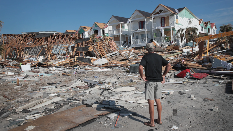
Katrina survivors wary of Helene
If a house was built after 2004, according to Florida building code, it will be likely to withstand 115-mph winds. But if a home was built before 2004, Florida Emergency Management Director Kevin Guthrie urged people to "make decisions on solid information."
With catastrophic storm surge expected along Florida's coast, northern Gulf Coast residents Gene and Margaret Taylor understand better than anyone about the tragedy that water can bring. As Hurricane Katrina approached in August 2005, the Taylor family fled their Gulf front home in Bay St. Louis, Mississippi, heading miles inland to his brother's home. The now legendary hurricane pulverized their home and community with a record-breaking 28-foot-storm surge.
Gene Taylor first thought his bare street looked like it did "when the French first arrived" in Mississippi during the late 1600s. "We could never have imagined the house would be gone," he recalled. Read more here.
− Dinah Voyles Pulver
Waffle House says Tallahassee locations will stay open ... for now
Known for its 24/7 service, Waffle House remains a beacon of hope during severe storms. And the good news for Tallahassee, Florida: The restaurant chain is keeping its doors open for now in Tallahassee, even as Hurricane Helene approaches.
"Right now, it's a wait-and-see attitude," Njeri Boss, vice president of food safety and public relations told the Tallahassee Democrat, part of the USA TODAY Network, after they had a virtual conference. "We will be monitoring the rest of the day, all night, and the foreseeable future."
Coined by Craig Fugate, nicknamed Florida's "Master of Disasters" as its director of emergency management, the "Waffle House Index," the safety benchmark is not only a crisis response signal for first responders but also an informal but reliable way communities gauge the severity of a disaster.
Red, the most severe level in the three-tier code, means the restaurant is deemed unsafe, the roads around it are blocked, and water and electricity are off, for instance. Boss adds that because of the uncertainty of Helene's path, no decision has been made to close any locations in the area.
According to Boss, that could change by later Thursday and the decision to close ultimately is up to local managers.
Contributing: Kyla A Sanford, Tarah Jean, Jeff Burlew and Ana Goñi-Lessan, Tallahassee Democrat; Reuters
Disclaimer: The copyright of this article belongs to the original author. Reposting this article is solely for the purpose of information dissemination and does not constitute any investment advice. If there is any infringement, please contact us immediately. We will make corrections or deletions as necessary. Thank you.


