Mountain terrain, monstrous rain: What caused North Carolina's catastrophic flooding
Forecasters had warned that Hurricane Helene would become a "once-in-a-generation" storm for portions of the Appalachians, and the forecast proved tragically accurate across mountainous portions of western North Carolina, eastern Tennessee, South Carolina and Georgia.
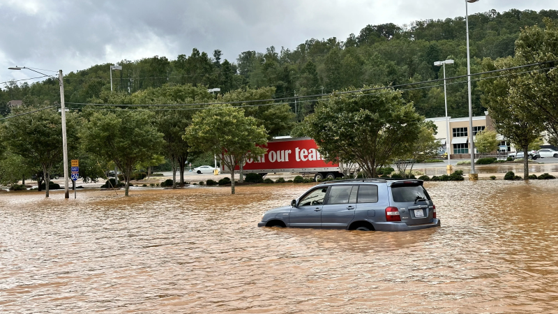
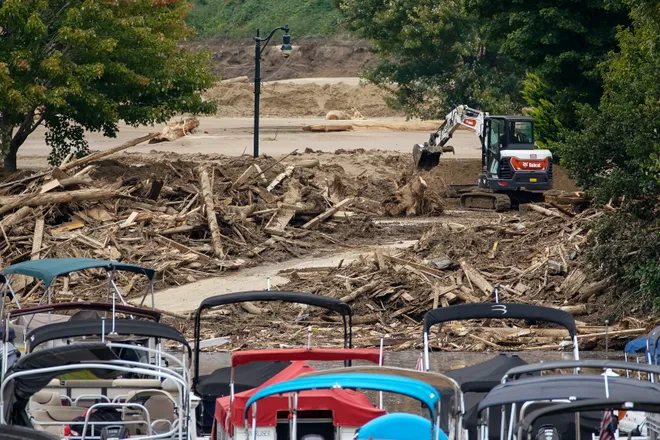
Now dozens of people are dead. Hundreds are missing. Homes and lives have been ruined. Roads destroyed. Tens of billions of dollars in damages.
Copious amounts of rain that fell before and during Helene across the region's unique terrain produced "the most severe flooding ever observed" in western North Carolina, Corey Davis, North Carolina assistant state climatologist, said in a blog post Monday.
Graphics:How flood damage is cutting off North Carolina communities from emergency relief
The catastrophic flood disaster was caused by an unfortunate combination of weather, hydrology and geography, experts told USA TODAY on Monday.
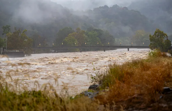
Almost unimaginable amounts of rains fell along a swath of the U.S. more than 200 miles long, rushing from tall peaks and turning tumbling mountain streams into unrecognizable torrents. Rushing waters flooded valleys, completely surrounding a hospital in East Tennessee and cutting off entire communities in Western North Carolina.

Rain before the storm
Helene’s rainfall would have been enough to cause flooding anywhere, but it was exacerbated by a weather front that had stalled over the Appalachians before then-Tropical Storm Helene arrived, said David Easterling, a rain expert with the National Oceanic and Atmospheric Administration’s National Centers for Environmental Information in Asheville, North Carolina.
Indeed, a thousand miles from Asheville, at 5 p.m. on Wednesday, Sept. 25, Hurricane Helene was at Category-1 strength storm with its center just north of Cancun, Mexico — still more than 500 miles and 30 hours away from its eventual landfall along the coast of Florida, Davis said.
But it was already raining in the mountains by then, as a line of slow-moving showers along a stalled cold front — fed by tropical moisture from the fringes of Helene' to the south — had set up from Atlanta through the southern Appalachians.
The setup between the front and Helene's enormous circulation was able to funnel a veritable water hose from the warm Gulf of Mexico into the mountains before the storm arrived. Then the storm, juiced by the water it absorbed on its own trip through the Gulf, delivered additional rain.
Over three days, rain amounts ranging from 6 inches to 30 inches or more fell across a region from North Georgia through western North Carolina, eastern Tennessee and into Virginia.

Mountains enhanced the rain
The mountains themselves in some places further enhanced the rainfall because they contribute to the lift that produces more rain in thunderstorms, Easterling said.
“It was at least 30 hours of rain,” he said. And some places got more than 25 inches.
“All that rain comes down and it’s channeled into smaller streams to flow into bigger streams,” he said. And those streams were rushing water toward the bigger rivers, he said.

Unfriendly terrain
The terrain not only worsened the rainfall, it also brought about colossal flooding.
"The terrain there — steep slopes and shallow soil — is not friendly for intense rainfall," Russ Barton of NOAA's National Water Center told USA TODAY. He said most of the infrastructure is in the valleys, which is where all the water flows during a flood.
All of that water was channeling into these larger rivers and flooding everything that was close to a river, said Easterling, who lives in the region and is among the thousands with no electricity.
High winds were taking trees down and knocking out power lines, as well as the mud slides and landslides that were taking poles down throughout the area, he said.
“You just get a mudslide and you might end up with 5 to 10 feet of mud. It cut off I-40 and that can take out a whole house,” he said. “There’s no telling how much loss of life there has been."

How much water was it?
Near Lake Lure, North Carolina, where iconic scenes from the movie "Dirty Dancing" were filmed, the flow in Cove Creek rocketed up with 32 times more water between Tuesday and Thursday, according to U.S. Geological Survey data. The area around Lake Lure and Chimney Rock suffered catastrophic damage.
At a water monitoring station on the French Broad River in Asheville, a gauge measured 12 inches of rain from Wednesday through Friday, based on USGS data. But the river also collects water from a network of creeks and streams to the north, where the rain fell in even greater amounts.
The flow in the river grew by 20 times between Tuesday and Thursday. As the height and volume increased the water turned increasingly cloudy, filled with mud and debris. The gauge didn’t report on Friday and Saturday, according to USGS data, then started again on Sunday after water levels began to recede.
At that point, the swollen French Broad was flowing at a rate of more than 240,000 gallons per second, enough to fill an Olympic-sized swimming pool every 2.74 seconds.
Contributing: Beth Warren, The Tennessean, USA TODAY Network.
Disclaimer: The copyright of this article belongs to the original author. Reposting this article is solely for the purpose of information dissemination and does not constitute any investment advice. If there is any infringement, please contact us immediately. We will make corrections or deletions as necessary. Thank you.


