Tampa Bay was spared catastrophic storm surge from Hurricane Milton. Here's why.
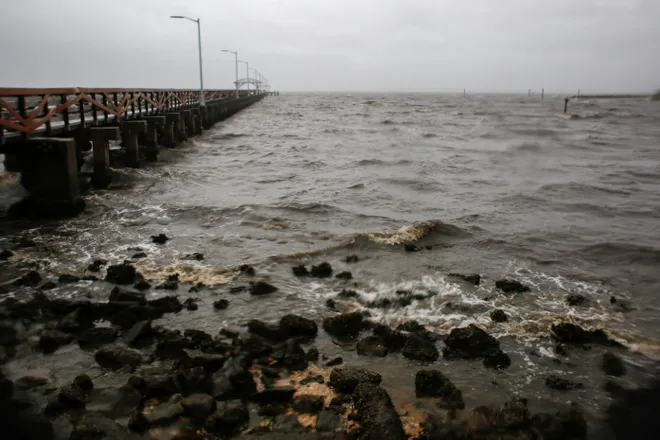
Water in Tampa Bay was returning back to normal levels Thursday morning following the passage of Hurricane Milton, which briefly caused "reverse storm surge" in the bay.
National Weather Service meteorologist Tyler Fleming confirmed to USA TODAY that Tampa Bay apparently was spared the massive storm surge that had been feared, instead experiencing a reverse surge that drove water away from the shoreline.
State Division of Emergency Management, in a post on social media, warned residents Wednesday night not to walk out into receding water because "the water WILL return through storm surge and poses a life-threatening risk."
But all was clear Thursday morning. Weather service meteorologist Stephen Shiveley confirmed to USA TODAY that water in the bay was "returning to normal levels."
Why was Tampa spared?
Storms that make landfall to the south of Tampa usually mean less storm surge for Tampa.
Because Milton roared ashore with its center of circulation just a little over 20 miles to the south, the especially vulnerable Tampa Bay narrowly averted the most catastrophic storm surge.
While water rocketed higher at tide gauges along the coast south of Siesta Key and Sarasota as Milton made landfall Wednesday, gauges plunged around the bay.

Tampa got 'very very lucky'
Tampa Bay itself was spared the worst of the storm surge yet again, AccuWeather hurricane expert Alex DaSilva said. Tampa's remarkable streak of avoiding a direct hit from a major hurricane continues with Milton.
The city has not taken a direct hit since 1921.
DaSilva said there's no geographical or topographical reason – or even a meteorological reason – for Tampa's streak. "They got very, very lucky," he said.
Wobbles and bobbles
Final landfall for Milton was right within in the hurricane center's "cone of uncertainty."
As had been predicted, small last-minute wobbles and bobbles in Milton's path can make a huge difference in where it makes landfall and thus where the worst storm surge is, Da Silva said.
"Luckily for Tampa, it hit to the south, near Sarasota," he said.
What is reverse storm surge?
Storm surge happens as a tropical storm or hurricane pushes water toward the coast, triggering catastrophic flooding along the shore and in bays and inlets.
It happened in Florida during Hurricanes Irma and Ian, WeatherTiger meteorologist Ryan Truchelut said.
With reverse storm surge, especially in larger storms, the opposite happens, AccuWeather meteorologist Paul Pastelok said after Hurricane Ian hit. “It can pull the water out because the wind flow is coming from land to ocean, and it pushes the water,” he said. “The power of the wind is incredible.”
The result is bare ground in some places, particularly along the shoreline, according to Pastelok.
The phenomenon can occur during any hurricane, whether it makes landfall along the eastern U.S. coast or in the Gulf, according to the National Weather Service office in the Tampa Bay area.

Why does reverse storm surge happen?
Storm surge can happen near and to the right of where a storm makes landfall, but negative water levels can occur to the left of the landfall location, weather service meteorologist Ernie Jillson has said. Tampa Bay was on the left side of where Ian made landfall as its winds blew from the northeast, he said.
And it appears to have happened again with Milton on Wednesday.
It depends on the shape of the waterway, and bays are more susceptible because they're like a bowl of water,” Jillson told USA TODAY. “They're protected by land on all sides except one, so that's why they're so susceptible to being emptied out.”
How dramatic the phenomenon appears depends on the storm's intensity, according to Pastelok.
(This story was updated with new information.)
Disclaimer: The copyright of this article belongs to the original author. Reposting this article is solely for the purpose of information dissemination and does not constitute any investment advice. If there is any infringement, please contact us immediately. We will make corrections or deletions as necessary. Thank you.


