Hurricane Milton from start to finish: What made this storm stand out
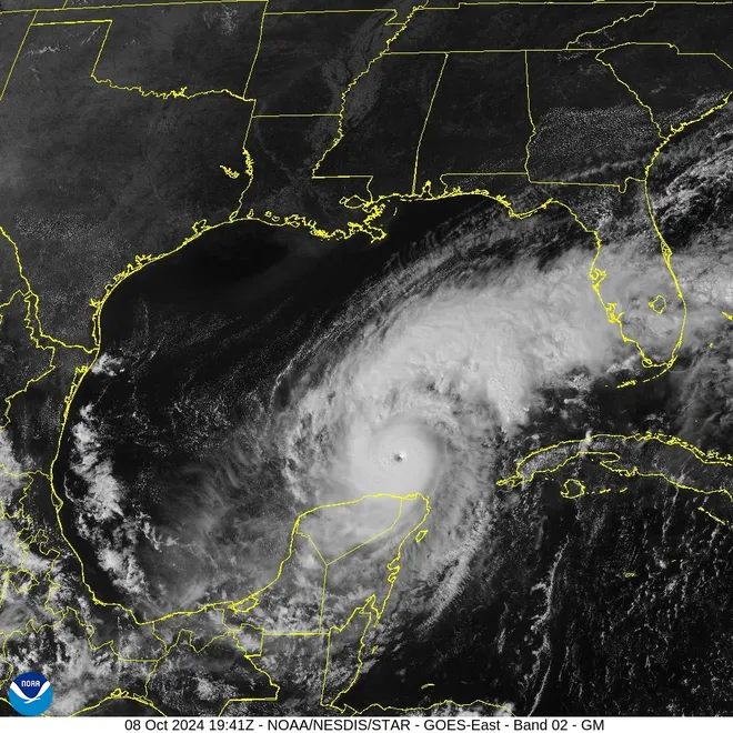
Born out of a typically uninspiring cluster of thunderstorms late last week in the western Gulf of Mexico, Hurricane Milton had a quick, intense life over the past few days as it roared across the Gulf and slammed into Florida late Wednesday.
The storm, still spinning out to sea as of late Thursday, might most be remembered for its extraordinarily rapid intensification, its short bursts as a Category 5 hurricane, its threat to the Tampa Bay region, and for the deadly outbreak of tornadoes it unleashed even before making landfall in Florida.
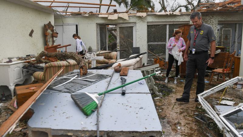
This is all in addition to Milton's ferocious onslaught of wind, rain and storm surge across the state, the threat of which forced an evacuation of some 2 million people.
Slow, then fast
The genesis of what would become Hurricane Milton was first monitored by meteorologists as early as Sept. 26. But it took over a week – until Saturday Oct. 5 – for the weather ingredients to come together for a named tropical storm to form.
But then, as early as Sunday, forecasters already were sounding the alarm about what was about to become Hurricane Milton: “This is an unusual and extremely concerning forecast track for a hurricane approaching the Tampa Bay area,” AccuWeather chief meteorologist Jon Porter said.
What was most unusual was its west-to-east path directly across the Gulf: Most storms that threaten Florida come up from the Caribbean Sea.

Rapid intensification record
Milton grew very strong very fast Monday, in what meteorologists call "rapid intensification," which is a dramatic rise in wind speed and a huge drop in barometric pressure in a short amount of time. The phenomenon, which appears to be more common with hurricanes in the Gulf of Mexico in recent years, is typically defined to be a tropical cyclone (whether a tropical storm or hurricane) intensifying by at least 35 mph in a 24-hour period.
Milton more than qualified, exploding from a 60-mph tropical storm Sunday morning to a potent 155-mph Category 4 hurricane − an increase of 95 mph in little more than 24 hours. That was among the fastest rates of intensification ever measured in the Atlantic basin.
Rare air: Milton hits Category 5
Milton kept intensifying, reaching Category 5 status on later on Monday. Hurricane Milton was the second Category 5 storm of the 2024 Atlantic hurricane season, joining Beryl. Category 5 is the highest rating a hurricane can attain, according to the National Hurricane Center. Maximum sustained winds in excess of 156 mph or higher on the Saffir-Simpson Hurricane Wind Scale are required for a hurricane to reach this intensity.
According to the National Hurricane Center, at the height of its wind speed of 180 mph, Milton was the Atlantic's fifth-most intense ever recorded. It was also the strongest tropical cyclone globally in 2024.
They are the rarest of hurricanes: Weather.com meteorologist Jonathan Erdman said there have only been 40 such hurricanes in the Atlantic Basin since 1924, according to NOAA's historical database. Only four hurricanes have ever hit the U.S. at Category 5 strength; the most recent being Hurricane Michael in 2018.

Deadly tornado outbreak
Milton's deadliest ingredient was the ferocious tornado outbreak it unleashed both the day before and day of landfall. In all, more than 100 tornado warnings were issued, and scores of tornadoes reported. Many of the people killed in Florida died in the tornado outbreak.
In addition, most of the severe damage reported so far across the state from Milton stemmed from the tornadoes, according to Federal Emergency Management Agency head Deanne Criswell.
Tornadoes aren't uncommon during hurricanes: Although hurricanes can spawn tornadoes up to about three days after landfall, statistics show that most tornadoes occur on the day of landfall or the next day, NOAA said.
One of the worst tornado outbreaks occurred during Hurricane Ivan in 2004, which caused a multi-day outbreak of 127 tornadoes. The deadliest hurricane-spawned tornado was in October 1964, when 22 people died in Larose, Louisiana, during a twister from Hurricane Hilda.
Contributing: Dinah Voyles Pulver, USA TODAY; Reuters
Disclaimer: The copyright of this article belongs to the original author. Reposting this article is solely for the purpose of information dissemination and does not constitute any investment advice. If there is any infringement, please contact us immediately. We will make corrections or deletions as necessary. Thank you.


