Storms spawning tornadoes in America's Heartland head for East Coast: Latest forecast
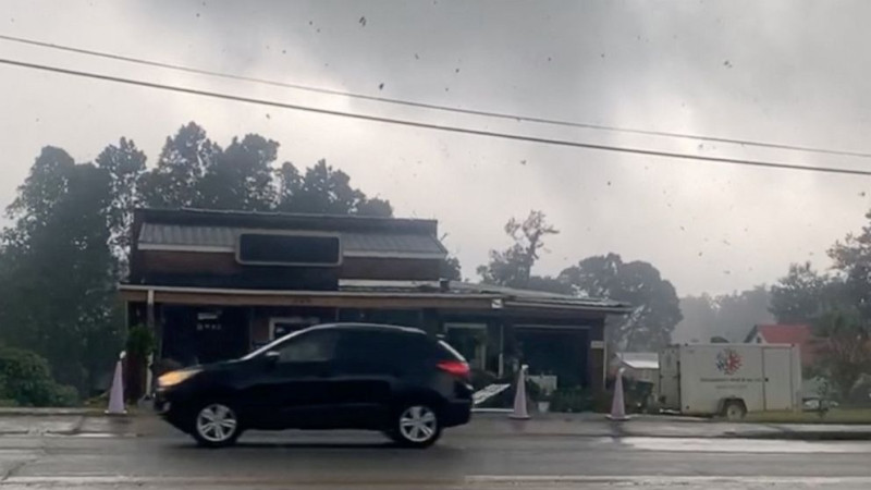
Stormy weather spawned tornadoes, triggered flash flooding, knocked out power and uprooted trees across the United States over the weekend.
There were more than 300 damaging storm reports from Colorado to Virginia. There were also 10 reported tornadoes -- eight across Iowa, Illinois, Nebraska and Colorado on Saturday and two in Illinois on Sunday, according to the National Weather Service.
MORE: Severe storms, unrelenting heat affecting millions in these US states

Storm damage was reported from Wichita, Kansas, through central Illinois and into Birmingham, Alabama.
Torrential rainfall led to dangerous flash flooding in parts of northeastern Missouri on Friday night, including in the town of Kahoka where more than 6 inches of rain fell within 6 hours. Water rescues were reported in the area.
MORE: Flash flooding emergencies prompt evacuations in Kentucky, Tennessee

Golf ball-sized hail was reported in Loveland, Colorado, and Almena, Kansas, on Saturday.
More than 40,000 people were left without electricity in Alabama on Sunday as gusty winds up to 61 miles per hour brought trees crashing down on power lines.
MORE: Tips on how to stay safe from a tornado

Hundreds of flights were canceled or delayed at Hartsfield-Jackson Atlanta International Airport in Georgia's capital after storms swept through the area late Sunday.
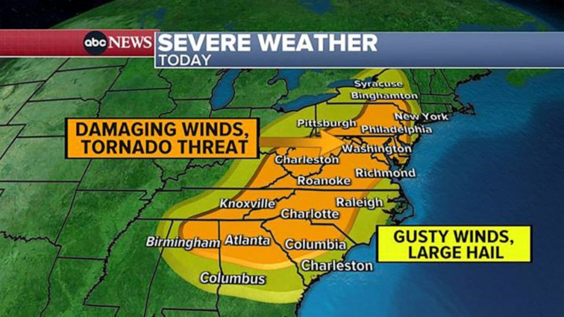
The threat for severe weather shifts eastward on Monday. Damaging winds, hail and tornadoes are in the forecast for a swath of the East Coast, from Georgia to New York state, including several major cities like Atlanta, Washington, D.C., Philadelphia and New York City. The bullseye for tornadoes and damaging winds will be from Harrisburg, Pennsylvania, to Washington, D.C. and into the Appalachian Mountains.
MORE: Floodwater safety tips to remember

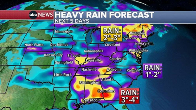
There is also a potential for flash flooding from Washington, D.C. to New York City and into parts of New England if the storms bring torrential rainfall while moving slowly through the area. The latest forecast shows there could be local rainfall amounts of 2 to 3 inches within a short period of time, which would cause localized flash flooding.
The severe weather is expected to hit the Appalachians early Monday afternoon before sweeping east across the forecasted threat area through the later afternoon and evening hours, clearing the East Coast after sunset.
Disclaimer: The copyright of this article belongs to the original author. Reposting this article is solely for the purpose of information dissemination and does not constitute any investment advice. If there is any infringement, please contact us immediately. We will make corrections or deletions as necessary. Thank you.


