Florida braces for 'extremely dangerous' storm as Hurricane Idalia closes in: Live updates
DEBARY, Fla . − Idalia grew to hurricane strength Tuesday, a treacherous tropical cyclone plowing past Cuba into the Gulf of Mexico and poised to intensify as it drives a potentially deadly storm surge toward the Big Bend area of Florida's west coast.
The National Weather Service warned of a "life-threatening, dangerous situation," saying the storm could make landfall as a major hurricane − meaning winds in excess of 110 mph.
"To put this system into the historical context, there are no major hurricanes in the historical dataset going backto 1851 that have tracked into Apalachee Bay. None," the advisory said. "Don't mess around with this."
Idalia, steering winds of 85 mph, was centered about 275 miles southwest of Tampa just before noon on Tuesday. A hurricane warning was issued along hundreds of miles of Florida coastline as the storm heads toward an apparent landfall along Florida's Big Bend.
Gov. Ron DeSantis, at a briefing, said highway tolls were being waived, shelters were opening and hotels were prepared to take evacuees. More than 30,000 utility workers were preparing to repair outages when the storm passes.
DeSantis said landfall appeared to be headed toward Taylor County, southeast of Tallahassee and one of the most rural and economically challenged areas of the state. But he said it was too early to know exactly where the storm would hit.
"Everybody on the Gulf Coast from Tampa Bay to northwest Florida must be vigilant," he said. "You're going to see some nasty weather."

What is rapid intensification?How Idalia could quickly become a major hurricane before landfall
Developments:
∎ Idalia was heading north at 14 mph Tuesday and could gain power and speed as it curves to the north-northeast late Tuesday and Wednesday, reaching sustained wind speeds of up to 125 mph before landfall.
∎ The center of Idalia was forecast to move over the eastern Gulf of Mexico, carrying a storm surge of up to 15 feet closest to where it makes landfall, possibly along Florida's Big Bend, on Wednesday morning.
∎ Idalia is forecast to remain a hurricane as it crosses into Georgia, before it moves over the Carolina coastline on Thursday, then out into the Atlantic where its future path remains uncertain.
Florida is on storm surge watch:Here's what that means
Follow the path of Idalia as storm heads for Florida
This forecast track shows the most likely path of the center of the storm but does not illustrate the full width of the storm or its impacts, and the center of the storm is likely to travel outside the cone up to 33% of the time.
Old nuclear power plant braces for Idalia
Approximately 85 miles north of Tampa along the Gulf of Mexico, the retired Crystal River Nuclear Plant sits near Idalia’s current forecasted path. Part of Duke Energy’s 5,100-acre complex that also includes active fossil fuel-powered plants in Citrus County, the old nuclear plant began decontamination and dismantling in 2020. The decommissioning process includes removing, packaging and shipping radioactive materials to off-site licensed disposal facilities and demolishing buildings, according to Duke Energy. The process is set to finish by 2027.
Keith Richardson, a spokesperson for Duke Energy, said the company has plans in place before and after Idalia. This includes securing items that could become airborne, storing equipment and ensuring generators are supplied should power be lost. Afterward, staff plan to conduct walkthroughs and inspections.
“In terms of the process, that’s all accounted for,” Richardson said.
− Eduardo Cuevas
Big Bend is mostly rural, thinly populated
The Big Bend, the region where the Florida panhandle transitions into the peninsula, is tree-packed and rural. Taylor County, the southernmost county in the Big Bend, is home to only about 22,000 people, ranking it 54th in population out of the state's 67 counties. To the western side, Franklin county ranks 64th, with a population of about 12,500. In 2021, about 19% of the residents in Franklin County lived below the poverty line, one of the poorest counties in the state.
Most of the population lives along the Apalachee Bay, a swampy swath of Florida where parts o the coastline remain undeveloped. Inland, three state forests connect the panhandle to the peninsula, and the tall pines that line the Big Bend Scenic Byway are very sensitive to wind damage and pose a threat to homes in high-speed winds.
− Ana Goni-Lessan, Tallahassee Democrat

Small wobble could drastically alter storm's impact
Floridians are anxiously waiting to see if Idalia follows the forecast track, or makes any kind of last-minute wobble to the east that could bring worse-than-expected impacts from wind and water. Hurricane Ian last year and Hurricane Charley in 2004 curved toward a landfall a little earlier than expected. Any movement closer to land could increase the effects of storm surge, rain and higher winds closer to the center of the hurricane.
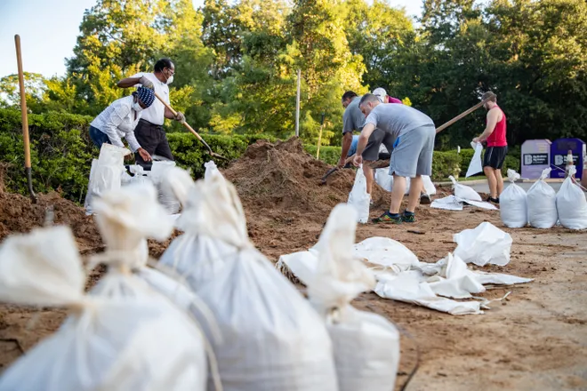
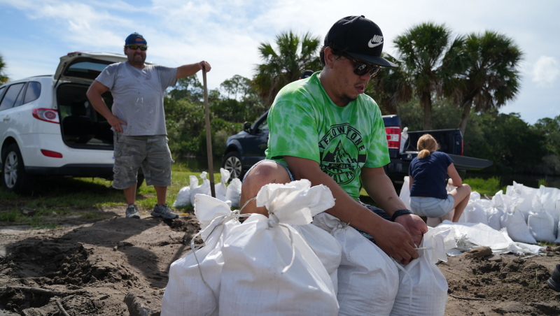
One neighborhood near Tampa Bay on Tuesday morning illustrated the gamut of emotions among residents on the west coast, but outside the forecast cone. One was putting up shutters, while another was laying sod. Kevin Guthrie, executive director of the Florida Division of Emergency Management, stressed that everyone should prepare for the worst.
“The storm is going to be here soon,” Guthrie said. “I implore you to finalize your disaster preparedness actions right now.”
Storm surge as high as 15 feet; evacuation orders in 22 counties
Idalia is forecast to make landfall overnight Tuesday or early Wednesday as a major hurricane with sustained winds near 120 mph. Storm surge − a sudden rise in water levels along beaches and into inland waterways − as high as 15 feet could slam the coast south of Florida’s Big Bend near the eventual point of landfall. Storm surge of at least 2-3 feet was possible along the state's entire west coast, depending on how Idalia's landfall coincides with full moon high tides. A storm surge of 4-7 feet could occur in Tampa Bay, the hurricane center warned.
Ryan Truchelut, chief meteorologist at Florida-based WeatherTiger, said Idalia will likely bring "catastrophic surge" to much of the west-central Florida and Big Bend coastline and a core of destructive winds to parts of North Florida. Idalia could become just the second Category 3 or higher hurricane − winds exceeding 110 mph − to make landfall there in the past 170 years, he said.
At least 22 of Florida’s 67 counties have evacuation orders in place and schools have closed in many counties as residents prepare for high winds and potential flash flooding.
What is storm surge?:Explaining a hurricane's deadliest and most destructive threat
Evacuation orders:Hurricane Idalia rapidly intensifying; 22 Florida counties under evacuation orders
A foot of rain, tornadoes possible
Rainfall of 4-8 inches is forecast along portions of the state's west coast and Panhandle, as well as along the path of the storm through Southeast Georgia and the eastern Carolinas, with isolated amounts up to 12 inches near where Idalia makes landfall, the National Weather Service said.
Tropical storm warnings were posted along all of Georgia's coast and much of the Florida and South Carolina coasts. Cities such as Charlotte and Raleigh, North Carolina, are likely to observe a few inches of rain as Idalia moves along the Carolina coasts before gradually curving northeastward over the Atlantic Ocean, AccuWeather said.
"Tornadoes can also occur to the east of the center of the circulation as it moves across Florida," AccuWeather Senior Meteorologist Dan Pydynowski said.
Weather Channel meteorologist Jim Cantore seen on Cedar Key
Sunday posts on X, the social platform formerly known as Twitter, that indicated The Weather Channel meteorologist Jim Cantore would show up in Florida were confirmed Monday. Cantore is long known for being in the middle of major storm events. An X user whose handle is Lt. Col. William Reid tweeted a photo from a Cedar Key restaurant, presumably Steamers: "Ran into the Jim Cantore while having dinner."
Photos of the restaurant's page on Facebook show a "dollar bill wall," similar to the dollar bill wall in Reid's tweet. Cantore has quite a history in Florida storms. You can read more here.
— Jennifer Sangalang, USA TODAY Network-Florida

Contributing: Jennifer Borresen
Disclaimer: The copyright of this article belongs to the original author. Reposting this article is solely for the purpose of information dissemination and does not constitute any investment advice. If there is any infringement, please contact us immediately. We will make corrections or deletions as necessary. Thank you.


