Tropical Storm Ophelia tracks up East Coast, downing trees and flooding roads
Tropical Storm Ophelia crossed into Virginia on Saturday afternoon, leaving a trail of floodwater and downed trees in its wake after making landfall in near a North Carolina barrier island earlier in the day.
Forecasters warn the storm will bring impacts to major cities including Washington D.C., Baltimore, Philadelphia and New York City.
On Saturday afternoon, Ophelia had maximum sustained winds of 40 mph with higher gusts and some coastal towns were experiencing several inches of floodwaters.
The governors of North Carolina, Virginia and Maryland declared states of emergency Friday. Some schools closed early as communities prepared for the storm’s arrival.
Ophelia is predicted to move over land as it tracks north, passing over Virginia, Washington, D.C., Maryland, Delaware, southern New Jersey and southeastern Pennsylvania. But the storm's impacts will stretch further, with rain forecast as far north as Massachusetts.
AccuWeather forecasters said Saturday Ophelia will lose wind intensity as it travels over land Saturday and Sunday, but the potential for flooding and storm surge will be high in some areas. The storm is expected to exit off the coast of New Jersey and return to the Atlantic Ocean by Monday morning, AccuWeather reported.
Because the storm is expected to travel over so much land, its impacts across multiple states "will be much more significant when compared to Hurricane Lee which passed offshore last week," AccuWeather reported.
Tens of thousands of customers were without power in North Carolina and Virginia Saturday, according to poweroutage.us.

Trees down, roads closed in New Jersey
Ophelia's winds downed trees in New Jersey, with conditions expected to worsen along the coast later Saturday.
In Manalapan Township, about 20 miles from the coast, winds knocked a tree onto a bilevel home, temporarily trapping three people and two dogs on the upper level and rendering the residence uninhabitable, the Asbury Park Press, part of the USA TODAY Network, reported.
The tree fell shortly after 11 a.m., Sgt. Philip Accatatta said, trapping two women, a man and two dogs. The fire department helped the people get out through a window and down a ladder, he said. Firefighters also carried the dogs down the ladder to safety. One of the women had a minor injury.
"They were pretty wet, but the dogs are okay," Accetta said.
In Atlantic City, roads were closed and photos posted by city officials on social media showed flooded streets.
Ophelia brings inland storm surge, flooding risk
The National Hurricane Center warned of "life-threatening inundation" from rising waters moving inland and asked residents to promptly follow evacuation orders. Storm surge impacts can affect more than just coastal areas, as rising waters travel up rivers far away from the ocean.
Coastal towns in North Carolina, Virginia and Delaware saw flooding Saturday morning, with several inches of water pooling along neighborhood streets.
In Bethany Beach, Delaware, entire neighborhoods were under several inches of water, leading to streets being closed, AccuWeather reported.
Rain from Ophelia to impact about a dozen states
The National Hurricane Center says rain from the storm will impact about a dozen states from North Carolina to Massachusetts, and as far inland as West Virginia. Most areas are expecting less than 4 inches of rain, but a few areas could see up to 6 inches.
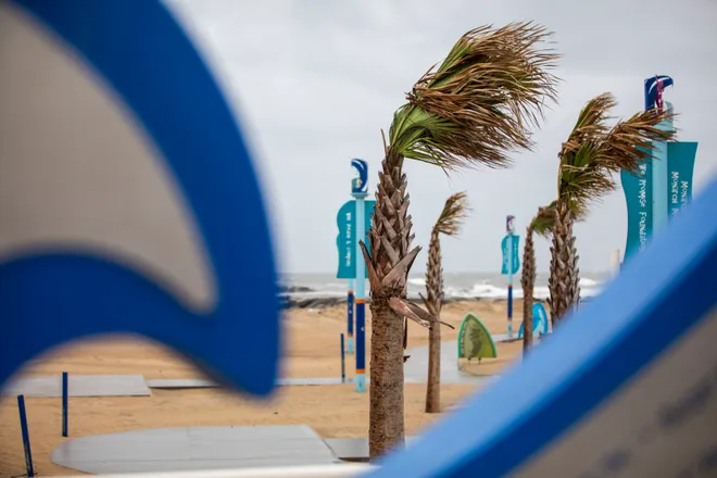
Wind is a concern too. On Saturday, tropical storm-force winds were extending over 300 miles from the center of Ophelia, the Hurricane Center said. Cape Lookout in North Carolina reported a wind gust of 71 mph.
Coastal Delaware and New Jersey are expecting wind gusts between 50 and 60 mph through Saturday evening, with the strongest winds coming mid-morning through early afternoon Saturday. Downed trees and power lines are also possible, forecasters said.
'Significant impacts' possible in Washington D.C. area
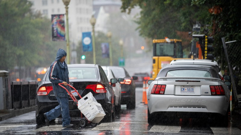
Rain was falling lightly but steadily with some moderate wind gusts across the Washington, D.C. region by Saturday afternoon.
But things were expected to pick up later in the day and residents in some areas should be prepared for potential “significant impacts,” said Austin Mansfield, a meteorologist at the National Weather Service in Sterling, Virginia.
Mansfield said heavier rain is expected through Saturday and overnight, and there could be some isolated incidents of flooding.
“Overall, flooding potential remains fairly limited across our area,” he said. But people living along the coast should still be on guard, he said.
“Just because we’re seeing some light rain right now doesn’t mean that we won’t see some more significant impacts later today,” he said.
Wind could have more of an effect in the region, he said. Saturated ground from the rain plus strong gusts of wind up to 40-50 mph could lead to some trees toppling.
“We've already seen some instances of trees down, so certainly could see that happen over the next 24 hours,” Mansfield said.
New York Gov. Kathy Hochul warned heavy rain would bring a flooding risk in New York City, Long Island and Hudson Valley this weekend. Forecasters said light to moderate rain has begun in the area as winds continued to increase in strength, peaking later in the day Saturday.

Tropical Storm Ophelia path tracker live
This forecast tracker shows the most likely path of the center of the storm. It does not illustrate the full width of the storm or its impacts, and the center of the storm is likely to travel outside the cone up to 33% of the time.
Tropical Storm Ophelia spaghetti models
A note about the spaghetti models: Model plot illustrations include an array of forecast tools and models, and not all are created equal. The hurricane center uses the top four or five highest-performing models to help make its forecasts.
Contributing: Associated Press
Disclaimer: The copyright of this article belongs to the original author. Reposting this article is solely for the purpose of information dissemination and does not constitute any investment advice. If there is any infringement, please contact us immediately. We will make corrections or deletions as necessary. Thank you.


