The weather is getting cold. Global warming is still making weather weird.
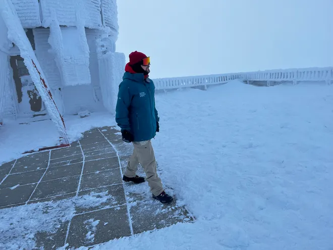
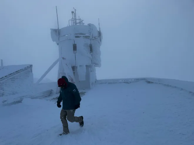
On the coldest days, Francis Tarasiewicz dons long johns, sweat pants, snow pants, hooded jackets, outerwear jackets, a scarf, gloves, mittens and goggles to make the trek a few hundred feet outdoors to the Mount Washington Observatory’s precipitation station.
When winds blow hardest at the 6,288-foot summit, New Hampshire's tallest peak, the trip takes up to 20 minutes and makes the flapping of his hood sound like a chainsaw.
Braving such harsh conditions, Tarasiewicz – a weather observer and education specialist at the observatory, a nonprofit research institution – and his colleagues have documented a year of crazy extremes on the mountain in 2023, with wild swings in rain, snow and temperatures.
Like thousands of researchers around the globe, they're compiling increasing evidence that climate change is bringing weirder weather, even in frigid locations like this northeastern landmark.
Notoriously fickle, the world's weather is lurching from one extreme to another more often and to a greater degree as the warming atmosphere pushes natural variability to new extremes, breaking records time and again, the researchers say.
These extremes in wilder weather – intense downpours, record heat waves and more – are “one of the most direct ways” people experience climate change, stated the latest National Climate Assessment, rolled out by the federal government in late November.
"People are experiencing climate change right now, right outside their windows, especially through the impacts of extreme weather events," said Allison Crimmins, director of this fifth national assessment.

Human-induced climate change alters the intensity, frequency and duration of many extreme events, during every season of the year, according to the new report. Drought, flooding and wildfire are becoming more frequent and/or severe, with cascading effects in every part of the country.
Globally, scientists expect this to worsen and to occur more frequently without greater and more urgent reductions in fossil fuel emissions.
U.S. and world leaders say it's not too late to alter the trajectory of future extreme events. The degree to which they continue or get worse depends on the choices we make now, the assessment states. ”The future is largely in human hands.”
Risk of extreme events is increasing
The increasing extremes aren't just setting records, said Daniel Swain, a climate scientist at the University of California Los Angeles. "They're shattering records."
The broken records and abrupt shifts in extremes this year are "signatures of warming" that have "hugely consequential" impacts, he said. “It’s something that I think we’re now starting to see in everything that’s unfolding all around us."
The biggest wild swings are in rainfall and drought, Swain said. The swings are driven by the impact of warming on the hydrologic cycle, one reason he refers to it as precipitation whiplash.
Others use terms such as global weirding, weather weirding and weather whiplash to describe how warming increasingly influences extreme swings in weather and climate.
With every increment of warmer temperatures, the atmosphere holds more water vapor that can fall as rain or snow, exacerbating extreme precipitation events.
That ability to hold water vapor increases exponentially as the temperature warms, changing much faster than the temperatures themselves, Swain said. Evaporation rates also increase as temperatures warm, which pulls more water from plants and soil and makes droughts more intense.
In page after page, the climate assessment spells out how warming temperatures cause the fluctuating extremes. Additional warming means more water vapor, more drought and more instability. Those impacts, in turn, cause more damage, greater losses, and increasing the risk of catastrophic consequences.
The number of hot days is projected to increase exponentially if temperatures continue to soar. Warmer temperatures and marine heat waves further expand the oceans, adding to rising sea levels along with the flow from melting glaciers. The assessment states sea levels are expected to further increase the number of coastal flooding events that disrupt lives in coastal communities, like the king tides that struck around the country in November.
The risk of two or more extreme events – known as compound events – occurring simultaneously or in quick succession in the same region also is increasing, said L. Ruby Leung, a climate scientist at the Pacific Northwest National Laboratory and lead author of the federal climate assessment's earth sciences chapter.
Warmer watersClimb aboard four fishing boats with us to see how America's warming waters are changing
Such compound events can cause cascading failures that threaten livelihoods, especially harming farmers and fishers, the report said. For example, disastrous combinations of warmer waters, drought and heavy runoff from extreme rains have triggered harmful algal blooms and contributed to mass die-offs of fish and shellfish in coastal regions.
Even extremes in different locations can be connected by complex natural systems, Leung said, for example the Canadian wildfires that blanketed residents across the northern U.S. in hazy acrid smoke over the summer.
Weather weirding worldwide
Wild shifts in extremes have been seen around the world this year, not just on Mount Washington. They include:
- California flipped from extreme drought to a stream of relentless atmospheric rivers. It had one of the snowiest seasons in decades in the Sierra.
- Phoenix and Houston set records for consecutive days of extreme high temperatures.
- A World Meteorological Organization committee is examining whether Freddy, a tropical cyclone in the South Indian Ocean over the summer, was the longest lasting tropical cyclone on record.
- Greece went from its worst wildfire season on record immediately to unprecedented flooding last summer.
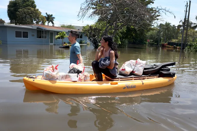
- In Fort Lauderdale, a sudden downpour dropped an unexpected 2 feet of rain, up to 20 inches of that in just six hours.

The Fort Lauderdale rain was “unbelievable,” said Steve Bowen, chief science officer and meteorologist with Gallagher Re, a global reinsurance broker. A similar heavy rainfall occurred in the city in November, at the same time as a seasonal high tide.
The dramatic weather fluxes occurring more often are leaving people and their insurance companies increasingly exposed, Bowen said.
'More extremes that are getting more extreme'
This year proved a new record for billion-dollar disasters in the nation. The National Oceanic and Atmospheric Administration has reported 25 billion-dollar disasters from extreme weather events.
In addition to direct economic losses, extreme weather events disrupt work, decrease property values, degrade air quality and increase deaths and illnesses. The assessment points out farmers are experiencing one hit after another, especially in the Midwest.
Denise Greer Jamerson’s family has seen its share of perilous weather in Lyles Station, Indiana, where six generations of her father's family have farmed for more than 150 years.
“There have always been problems with the weather, but now it’s becoming more extreme,” Jamerson said. "We’re getting more extremes that are getting more extreme."
Within the past two years, they endured a severe drought, followed immediately by so much flooding rainfall that her father, Norman Greer, planted once, then planted again but could never get a crop growing.
"We saw a lot of barren fields because the farmers could not get into the fields because it was too wet," she said. "It’s really crazy, it’s stressful and the costs are astronomical."
Festivals forced to adaptClimate change disrupts historic weather patterns
Back east on Mount Washington, years of temperature data show the extreme events are increasing, especially during the spring and fall, Tarasiewicz said.
Every month last winter saw above average temperatures, with a January average 10 degrees above normal. Despite that warming, in February, the mountain matched its all-time record low of minus 47.0 degrees. The wind chill dropped to an unofficial minus 108 on Feb. 4, which several experts said was likely the lowest since meteorologists began calculating wind chills.

By the time summer rolled around, precipitation was setting records. This summer was the all-time wettest on Mount Washington. The 48.3 inches of precipitation topped the 30-year normal by 23.15 inches. It was also the snowiest June in 91 years of recordkeeping.
The mountain will experience periods when a “pretty impressive” snowfall will build up, then temperatures suddenly rise above freezing for a few days, and it starts raining, melting away some of the built up snow, Tarasiewicz said.
These bouts of warmer or rainier than normal weather are becoming more intense in duration and magnitude, he said, even amidst the frigid temperatures already beginning on the mountain.
Melting permafrost:The Arctic permafrost is 1,000 years old. As it thaws, scientists worry what it might unleash
Disclaimer: The copyright of this article belongs to the original author. Reposting this article is solely for the purpose of information dissemination and does not constitute any investment advice. If there is any infringement, please contact us immediately. We will make corrections or deletions as necessary. Thank you.


