Storm slams East Coast with wind-swept rain flooding streets, delaying travel: Live updates
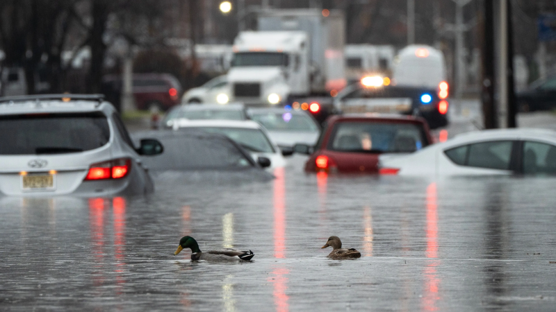
NEW YORK – An intense storm system battered the Northeast with torrential rains and fierce winds on Monday, snarling traffic, delaying flights and knocking out power across the region.
Wind gusts of up to 50 mph were recorded in New York and New Jersey, where between 2 and 4 inches of rain fell throughout the morning, according to the National Weather Service. In Connecticut, winds speeds of over 60 mph toppled trees and power lines. Weather-related warnings were issued in more than a half dozen states along the East Coast from North Carolina to Maine.
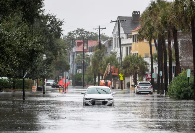
Flooding across New York City, New Jersey and Philadelphia left streets completely underwater ahead of rush hour. Mass transit systems, including the New York City subway, were plagued by delays and cancelations. Bridges across the tri-state area were subjected to travel restrictions, further stalling traffic.
Meanwhile, more than 400,000 utility customers from Virginia up to New Hampshire were without power through the morning, according to PowerOutage.us.
In the Hudson Valley area of Upstate New York, Adrienne Auchmoody, 79, was awoken at around 2 a.m. by the sound of intense winds blowing against her home.
"You could hear it howling, and that's always a scary thing," she told USA TODAY. "It was pretty loud."
When she got up hours later, Auchmoody heard the rush of the brook behind her house. From her window she could see the forceful movement of the water as it passed through on its way toward the Hudson River. While Auchmoody, a member of a local organization that feeds volunteer firefighters, did not have any flooding she said she knew others in the area who reported water creeping into their basements.
The storm rolled northward up the Mid-Atlantic states and reached New England on Monday morning after pounding Florida and the Carolinas with rain over the weekend. The system strengthened rapidly just off the southeast coastline Sunday afternoon, according to the National Weather Service.
See power outage maps:400,000 homes, businesses without power as storm bears down on Northeast

Developments:
◾ The storm cleared out of most parts of New Jersey and New York City by 10:30 a.m., according to the NWS.
◾ In Rhode Island, the storm's most intense impacts will coincide with high tide Monday afternoon. Forecasters with the National Weather Service say water levels at Fox Point in Providence will approach 10 feet. The last time water levels reached such heights was in 1991, when Hurricane Bob rose water levels to 9.9 feet.
◾ Citing strong winds, officials prohibited tractor trailers, minibuses, step vans, motorcycles and house trailers from using the Verrazzano Bridge, which connects Staten Island and Brooklyn. The bridge was temporarily closed for two hours beginning at 4 a.m.
Schools closed, flights canceled and delayed
School districts across the Northeast canceled classes or opened late on Monday because of the inclement weather.
Most schools across Connecticut were closed on Monday, due to the high winds and flooding threat, according to a list compiled by the WFSB television station. Several public school districts in New York and New Jersey ceased operations for the day. In Massachusetts, the Blackstone-Millville school district and Framingham Public Schools canceled classes. In Philadelphia, at least two school districts closed while at least two others delayed the start of classes.
Major airports across the Northeast reported flight cancelations and delays. Over 120 flights in New Jersey, New York City and Boston were delayed and about 100 were canceled, according to FlightAware. Flights out of Boston Logan International Airport have been delayed by an average of 1 hour and 45 minutes, the Federal Aviation Administration says.
Storm system drenched southeastern states over the weekend
The storm brought heavy rains across the Southeast during the weekend, flooding streets and raining out holiday celebrations.
Authorities rescued dozens of motorists stranded by floodwaters in Georgetown, South Carolina, county spokesperson Jackie Broach. But there were no immediate reports of injuries or deaths.
Since late Saturday, more than nine inches of rain fell in the area, located about 61 miles northeast of Charleston.
The storm also dumped up to 5 inches of rain across Florida. The National Weather Service issued flood warnings, minor flooding advisories and coastal advisories for parts of the state as strong winds swept up water along the coast.

After storm subsides, cold air follows
Colder air behind the storm is expected to trigger lake-effect snow across the Great Lakes and into the Appalachians and upstate New York on Tuesday, according to the Weather Prediction Center.
"Even though the big storm will begin to depart the Northeast Monday evening, the huge circulation of the storm will overspread the entire eastern U.S. with very blustery conditions," the Weather Prediction Center said.
Contributing: The Associated Press
Disclaimer: The copyright of this article belongs to the original author. Reposting this article is solely for the purpose of information dissemination and does not constitute any investment advice. If there is any infringement, please contact us immediately. We will make corrections or deletions as necessary. Thank you.


