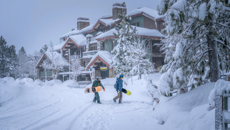
How much snow fell in Northern California and the Sierra Nevada? Snowfall over 7 feet
Winter storm warnings were in effect for parts of Northern California and Southern Oregon on Monday as more snow is expected in the region following a dayslong blizzard that slammed the Sierra Nevada with hurricane force winds and several feet of snow.
Up to 10 inches of snow is forecast to fall at elevations above 3,500 feet, according to the National Weather Service. Rain is slated to lash the coast of Northern California and the Pacific Northwest. Meteorologists warned that persistent snowdrift could hamper clean up efforts from the intense weekend blizzard.
"Travel could be very difficult to impossible," the weather service said, adding that a winter storm warning will remain in effect until at least 4 p.m., local time, Tuesday. "The hazardous conditions could impact the morning or evening commute. Gusty winds could bring down tree branches."
Through Sunday, the life-threatening storm dumped over 7 feet of snow at Donner Peak, an 8,000 feet summit in the Sierra Nevada mountain range, the weather service said. Areas surrounding Reno, Nevada, recorded more than a foot of snow.

Across the Sierra Nevada on Monday, residents and tourists were still being impacted by the weekend storm. More than 8,000 utility customers – mostly in Sierra County – were without power, according to a database maintained by USA TODAY. Sections of major highways remained closed to semi-trucks and vehicles without chains or snow tires, including a stretch of I-80, near the Nevada state line, according to the California Department of Transportation.
On Monday, multiple school districts in northern California canceled classes, including the Tahoe Truckee and Lake Tahoe unified school districts. Near Reno, Nevada, the Washoe County School District delayed the start of classes by several hours; multiple schools in the district were closed.
The powerful blizzard began late last week but its most intense conditions occurred on Sunday, when wind gusts reached 190 mph and white out conditions left hundreds of people stranded in their cars for several hours. Parts of Nevada, Utah and Colorado received some heavy wind gusts and several inches of snow.
Moisture from the winter storm led a tornado to form on Friday in Madera County, 90 miles north of Corcoran, damaging an elementary school, according to the weather service office in Hanford, California. On Saturday, a tornado warning was issued in the Kings County town of Corcoran, 50 miles south of Fresno, where a possible second tornado formed.
What were some of the biggest snow reports in California?
Sugar Bowl – 7.42 feet Donner Peak – 7.25 feetSoda Springs – 7.0 feetKingvale – 6.08 feetLake Spaulding – 6 feetCentral Sierra Snow Lab – 5.3 feet
How is climate change affecting snowfall in California?
The snow lines are moving higher, and they’re moving higher with snow from atmospheric rivers than with snow associated with other winter storms, said Alexander Gershunov, a research meteorologist at Scripps Institution of Oceanography at the University of California San Diego.
An analysis by Gershunov and colleagues last year found that snowlines – the points marking where rainfall turns to snow – have been rising significantly over the past 70 years, and will continue to do so over the remainder of this century.
In the high Southern Sierra Nevada range, for example, snowlines are projected to rise by more than 1,600 feet by end of century.
The snowlines are rising even higher than that when comparing snow associated with atmospheric rivers to other snow events, Gershunov told USA TODAY on Monday.
In the eastern United States, a group of scientists recently found that more snow is falling during the top 5% of snowiest days, even though snow is falling on fewer days a year on average.
When it’s cold enough to snow, warmer storms produce more snow, Gershunov said. “There’s just more vapor to produce precipitation, as long as it stays below freezing.”
Scientists expect to see a similar trend in California, but he said that has not been documented yet. An increase in the amount of snowfall on the snowiest days has been documented along the coast in the Pacific Northwest, according to data provided by Brian Brettschneider, an Alaska-based climate scientist.
Contributing: John Bacon, Jorge L. Ortiz and Thao Nguyen
Disclaimer: The copyright of this article belongs to the original author. Reposting this article is solely for the purpose of information dissemination and does not constitute any investment advice. If there is any infringement, please contact us immediately. We will make corrections or deletions as necessary. Thank you.


