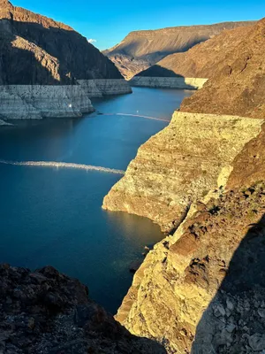
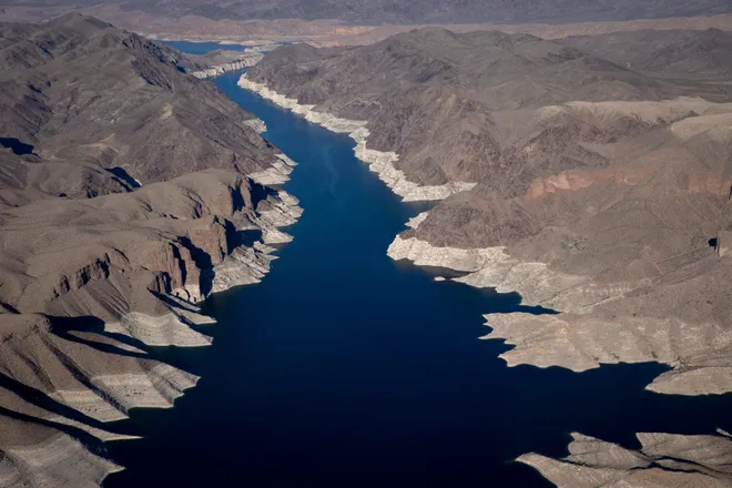
Lake Mead's water levels rose again in February, highest in 3 years. Will it last?
Lake Mead's water levels stayed high again last month amid a historic water shortage, rising again and passing January's mark to become the highest point in nearly three years.
According to measurements taken at the end of February by the Bureau of Reclamation, Lake Mead's water levels were reported to be 1,076.52 feet, higher than levels taken at the end of January, when they were measured at 1,072.67 feet.
Prior to this year, the most recent highest level was recorded in April 2021, when it was measured at 1079.30 feet.
The lake's water levels remained high in the month following the heavy winds, rain and snow that moved through California in January from an atmospheric river weather event, also known as a "Pineapple Express."

Earlier this month, a blizzard pounded Eastern California and the mountains along the Nevada border in a powerful storm that dumped heavy snow and brought howling winds with gusts that hit 190 mph.
Water levels projected to fall
Although water levels remain high for now, experts previously told Newsweek that it would depend on future storms to fill the reservoirs in Lake Mead and Lake Powell in Utah and Arizona.
The recent water levels may be the peak for Lake Mead for the foreseeable future, according to a 24-month operation plan from the Bureau of Reclamations, which estimates levels wills steadily drop over the remainder of 2024, ending 17 feet lower by December.
In 2025, the projection estimates that water levels may be at its lowest since the 1930s, when the lake was filled.
Pineapple express:Satellite shows California snow after atmospheric river, but it didn't replenish snowpack
Where is Lake Mead?

Lake Mead is reservoir in Nevada and Arizona formed by the Hoover Dam on the Colorado River, and is the largest reservoir in the U.S. in terms of water capacity.
It was first flooded in 1935 when the Hoover Dam was created, and provides water to Arizona, California, Nevada and some of Mexico.
What were Lake Mead's water levels in 2023?
Lake Mead's water levels rose slowly throughout 2023, although the measurements were lower than in the previous two years. Water level measurements began at 1,046.97 feet in January and ended at 1,068.18 feet in December.
The lake has experienced record lows in water levels in recent years, with the first water shortage announced in 2021 after years of chronic overuse and drought.
Despite the recent higher water levels, Lake Mead's launch ramp remains closed due to climate change and the 20-year ongoing drought that has "reshaped the park's shorelines," according to the National Park Service, which operates a recreation area on the lake.
Is the Southwest still in a drought?
Some areas of the Southwest are still in drought, although nearly all of California is no longer under that classification. Drought areas in California are in the north along the Oregon border, the east along the Nevada border and the southeast along the Arizona border.
Lake Mead, which spans across Nevada and Arizona, is currently reporting abnormally dry to moderate drought levels, according to the Drought Monitor.
Much of Arizona is classified as D0 (abnormally dry), with patches of the state in D1 (moderate drought) and D2 (severe drought), according to the U.S. Drought Monitor.
Almost all of New Mexico is under drought, with many areas of the state reporting D1 (moderate drought) and some areas reporting D3 (extreme drought) and D4 (exceptional drought) levels.
Disclaimer: The copyright of this article belongs to the original author. Reposting this article is solely for the purpose of information dissemination and does not constitute any investment advice. If there is any infringement, please contact us immediately. We will make corrections or deletions as necessary. Thank you.


