Midwest braces for severe thunderstorms, possible tornadoes, 'destructive winds' on Monday
A wide swath of the Midwest is bracing for a storm system that could bring large hail and damaging winds and possibly trigger tornadoes on Monday evening before it expands to bring more thunderstorm risks on Tuesday.
The storm is expected to pummel the southern and central Great Plains, stretching from northern Texas to South Dakota, where scattered thunderstorms could develop into tornadoes overnight, according to the National Weather Service. Isolated, severe storms could also hit the Ohio Valley and Mid-Atlantic "with a risk for mainly damaging winds and hail."
The National Weather Service placed more than 1.5 million residents of Nebraska and Kansas, including Lincoln and Salina, under a Level 3 enhanced risk of thunderstorms in anticipation of the storms.
More than 12 million people in Oklahoma, Missouri, and northern Texas were placed at a Level 2, or slight risk of thunderstorms. The slight risk level also applies to parts of Virginia, where a front approaching from the north amidst high temperatures in the 70s and 80s could also trigger thunderstorms on Monday afternoon.

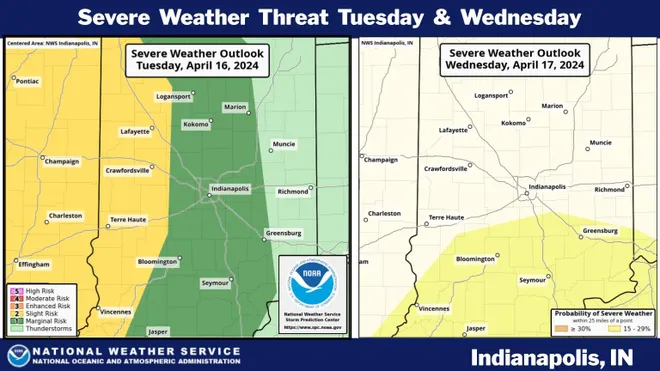
The storms are predicted to move north on Tuesday and Wednesday, where they could drop up to 2 inches of rain on Iowa and southern Wisconsin.
On Tuesday evening, another round of "potentially life-threatening" thunderstorms could target an area stretching from the South, including Little Rock and Memphis, up to the Great Lakes and Chicago. Those areas face downpours, hail, and possible tornadoes, as well as wind gusts of up to 70 mph, AccuWeather forecasted.
The threat of thunderstorms on Tuesday could affect a wide area, according to AccuWeather. Parts of southern Iowa, Illinois, and Missouri are at risk of potentially destructive hail, wind, and tornadoes through Tuesday night.
A burst of warm weather in the Midwest late last week, coupled with increased humidity and jet stream energy, created the perfect environment for thunderstorms to develop early this week, according to AccuWeather.
In Lincoln, Illinois, highs could hit 85 degrees on Monday, as compared with an all-time April high of 93 degrees set in 1930. Omaha, Nebraska saw a high of 89 degrees on Sunday.
Watch:Pittsburgh barges break loose in Ohio River, damage marina
High winds increase fire risk farther west
Strong winds triggered by the storm also threaten to spread wildfires in parts of the Southwest and the Plains. The National Weather Service placed fire conditions at a critical level for a stretch of western Texas, New Mexico, Colorado, Kansas, and the Oklahoma Panhandle for Monday and Tuesday.
The National Weather Service in Boulder issued a red flag warning for Colorado's plains and the Palmer Divide on Monday. A large stretch of central and eastern New Mexico could also face "strong to potentially damaging winds," creating a critical to extreme fire hazard on Monday, according to the service.

The thunderstorms come after another storm system dumped rain across the U.S., including the Great Lakes and parts of the Northeast last week.
Cybele Mayes-Osterman is a breaking news reporter for USA Today. Reach her on email at cmayesosterman@usatoday.com. Follow her on X @CybeleMO.
Disclaimer: The copyright of this article belongs to the original author. Reposting this article is solely for the purpose of information dissemination and does not constitute any investment advice. If there is any infringement, please contact us immediately. We will make corrections or deletions as necessary. Thank you.


