Tornadoes hit parts of Texas, more severe weather in weekend forecast
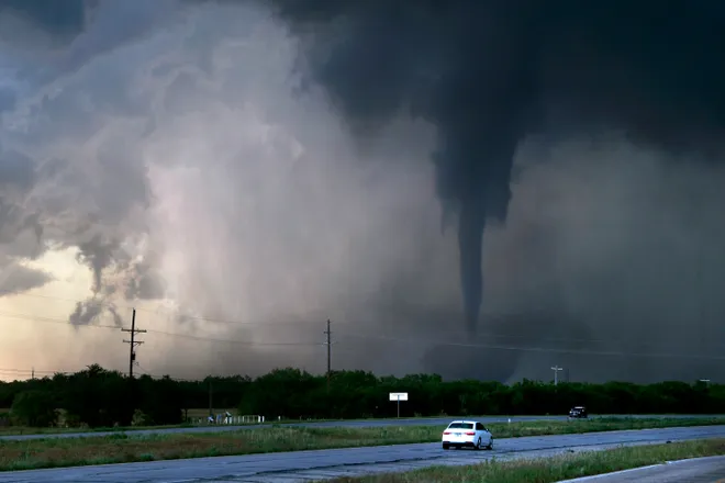
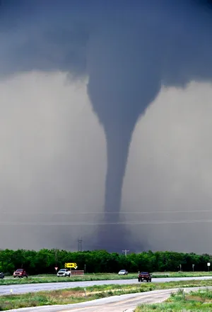
Multiple tornadoes hit Texas on Thursday near Abilene, including one in Hawley that was caught on camera by storm chaser Russ Contreras.
"We've had multiple confirmed tornadoes this evening," said the National Weather Service office in San Angelo on X Thursday evening. "Please stay weather aware and make sure you have a way to receive warnings!" The weather service also posted a map showing where the tornadoes hit.
The Hawley Independent School District said in a statement on Facebook that the "Hawley community has been hit pretty hard and we have several families that have lost homes." The district said that while the school seems to have been spared major damage, there is "pretty substantial" flooding on the grounds.
The district also said that Friday will be a flex day for students, meaning the school will be open and on regular schedule for students that can attend, however attendance is not mandatory and will not be taken.
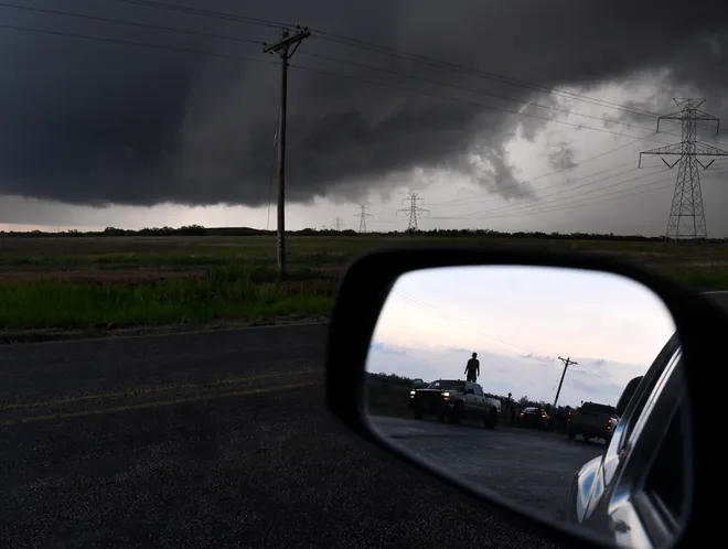
Photos of the Hawley, Texas tornado


San Jacinto River evacuation order
In the southeast portion of the state, Harris County Judge Lina Hidalgo on Thursday issued a disaster declaration and a mandatory evacuation for residents on the East Fork of the San Jacinto River in Houston during a news conference.
Hidalgo said residents must evacuate their homes because of high water risk and that they should leave as soon as possible. Officials said that section of the San Jacinto River is nearing 78 feet above sea level, which is about three feet below Hurricane Harvey water levels.
Some 24-hour rainfall totals exceeded seven inches in the region, reports FOX Weather, with storm totals over the past few days nearing about a foot.
Texas weather forecast for Friday and the weekend
The National Weather Service office in San Angelo said that severe weather potential continues in the area Friday with a marginal to slight risk of severe storms in the afternoon and evening.
"Large hail, damaging winds and even a tornado will again be possible," the NWS said.
As for Saturday, the weather service said more widespread thunderstorms during the day and night will lead to "a chance for heavy rainfall across portions of West Central Texas, mainly across the Big Country and the Heartland."
The NWS says the rainfall could be heavy enough to cause flash flooding of streets, creeks, streams, and other low-lying areas. Additionally, storms Saturday will pose the "greatest risk for very large hail greater than 2 inches in diameter."
A Flood Watch is in effect in the Houston-Galveston area through Friday, with flooding being especially hazardous at night, the NWS said.
"Scattered to numerous showers and thunderstorms continue today, mainly north of I-10 and east of I-45," the NWS said Friday morning. "Heavy rainfall potential exists and could result in flash flooding. A few storms may become strong to severe with hail and strong gusts as the main risks," the NWS said.
Texas severe weather watches and warnings
Here's a look at a map of the watches and warnings across the state.
Texas power outage map
Nearly 30,000 power outages have been reported across Texas as of 6:40 a.m. local time Friday, according to a USA TODAY power outage tracker, including over 12,000 in Harris County.
Gabe Hauari is a national trending news reporter at USA TODAY. You can follow him on X @GabeHauari or email him at Gdhauari@gannett.com.
Disclaimer: The copyright of this article belongs to the original author. Reposting this article is solely for the purpose of information dissemination and does not constitute any investment advice. If there is any infringement, please contact us immediately. We will make corrections or deletions as necessary. Thank you.


